Description
Learn Geography the Fun Way!
Travel is my favorite way to learn geography. If you can’t visit our 50 states in person, then God Bless the USA Exploring States & Territories is the Next Best Thing! We explore each state as if we are on a trip exploring the exciting spots.
Here’s how God Bless the USA Exploring States & Territories works! After an introduction looking at the entire country, we will study the states region by region.
Each state regional section opens with an introduction and mapping assignments.
- Overview of Region
- List of States (or territories) in Region
- Map of USA—student colors in region
- Regional Resources
- Regional Climate
- Regional Culture/Food
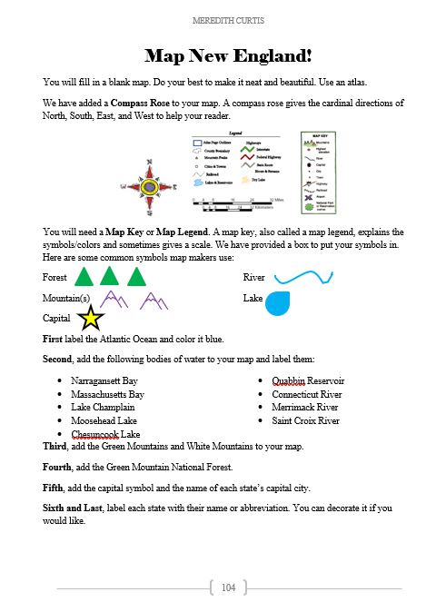
- Regional Blank Outline Map with Directions to Create Own Map (not for territories)
Students make a map key and create a map with landforms, the capital of each state, and the name of each state.
After the introduction to the region, we learn about each state! Four pages are devoted to every state and inhabited territory.
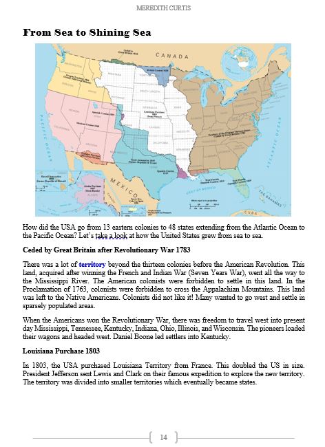
Individual State Studies: First Two Pages
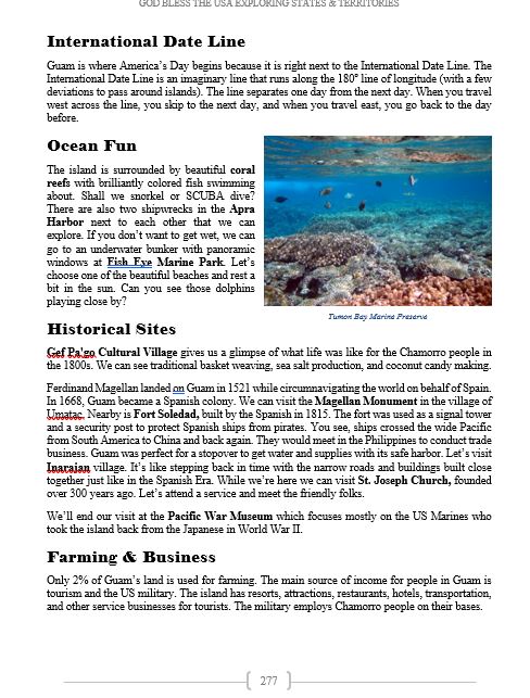
Highlights from Each State
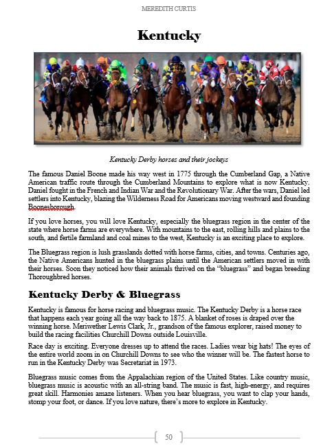
- We can’t see everything in every state. I wish we could. Highlighting landmarks, special places, and fun spots to visit, we spend two pages per state taking our own personal tour.
- The reader and the author (me!) visit beaches, museums, presidential homes, caves, ghost towns, and gardens. We go sightseeing, swimming, hiking, spelunking, boating, horseback riding, and driving to explore the USA.
Geography
- In the first two pages of each section, I give a brief overview of the physical geography and climate in one paragraph.
- In the course introduction, I share a basic geography map of the different physical geographical zones (coastal lowlands, Rocky Mountains) across the country.
- There is a bigger map of the USA’s Physical Geography in the “Resources” section of the book with detailed descriptions of each one. Please encourage student to use this!
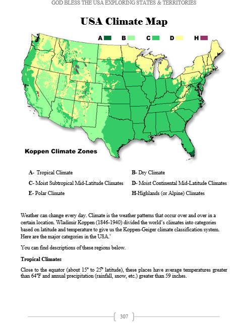
Climate
- Brief climate description
- In the course introduction, I introduce a climate map (Koppen Climate Zones) giving a birds-eye view the nation’s climate.
- For a bigger map and more details in the description, use “Resources” section of the book. Please encourage student to use this!
Business & Farming
- Manufacturing
- Farming
- Ranching
- Fishing and the lumber industry are mentioned if it is an important part of the economy or culture.
- Mining.
Did you know every state mines something?
When I think of mining, coal, gold, and silver come to my mind. While those are mined in the USA, there are many things that are mined that you haven probably never thought or heard of before.
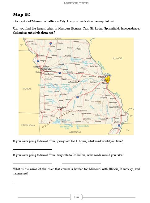
Individual State Studies: Third Page
The third page has a map (with bodies of water, cities, and major highways) with simple instructions.
Mapping
- Students circle capital and biggest cities (in population).
- Students answer fill-in-the-blank questions based on the map.
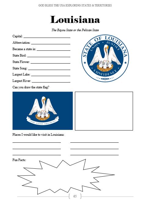
Individual State Studies: Fourth Page
Research is an important life skill, so we give you one page of research for each state and territory.
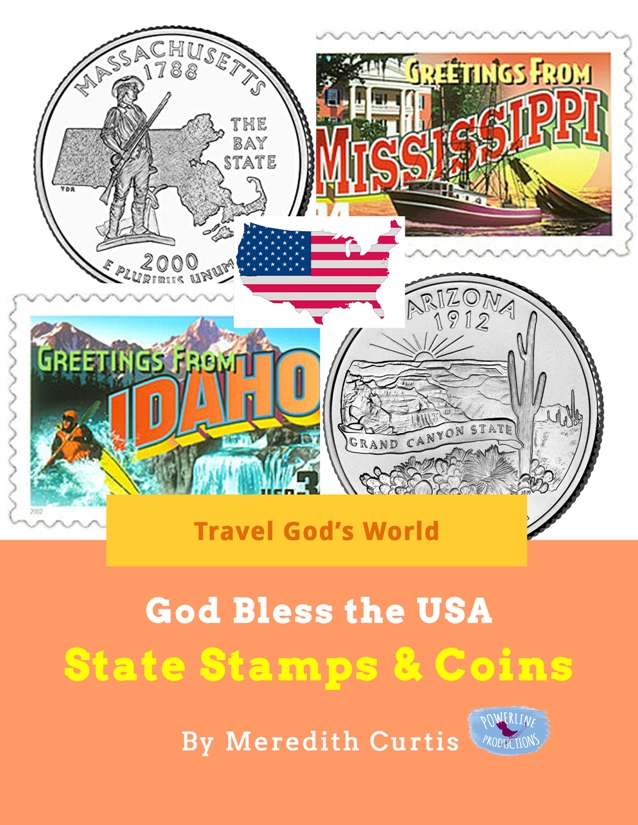
- Capital
- State (or Territory) Bird
- State (or Territory) Flower
- State (or Territory) Fun
- Largest Lake
- Largest River
- Statehood Date
- Fun Fact
- Places to Visit
Drawing
- The flag and seal are on this page in full color (eBook) or black and white (print book)
- Students draw the flag.
Bonus: Resource section with charts, maps, blank outline maps, and sample schedule to use in your USA states studies.
Are you ready for a grand adventure from sea to shining sea? Join us today and learn geography the fun way with Travel God’s World!
God Bless the USA Exploring States and Territories is available in print (you will need one per student) and eBook (you can make as many copies as you need for your own family). Created for upper elementary and middle schoolers, this geography course is a fun study for the whole family, too.
You can purchase the print version of God Bless the USA Exploring States and Territories at Amazon.
Purchase the eBook right here—Scroll Up!
(you can also purchase the e-book at PayHip and TeachersPayTeachers )


christylange –
This book kept my middle school boys engaged the whole school year. Each week they enjoyed researching several states, discovering basic facts and interesting trivia. They practiced many different map reading skills and read about fascinating places to visit in each state which sparked interest in discovering even more about each place and dreaming of travel, camping, vacations an more! It was a fun way to explore our country without ever leaving our home!